Water Detection & Geophysical Equipment
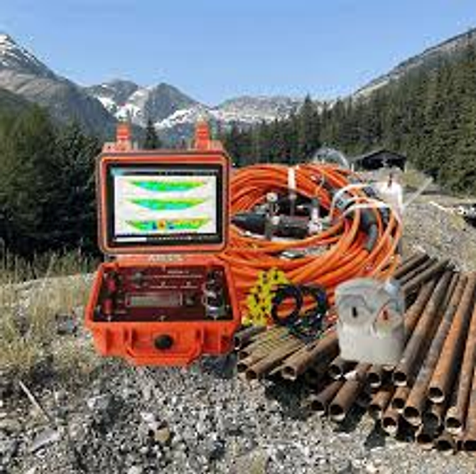
Subsurface Imaging Resistivity Meter
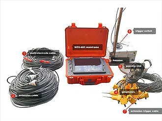
Multi-channel resistivity imaging system for tunnel and cavity detection, mine void mapping and groundwater investigation.
Overview
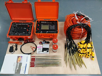
The subsurface imaging resistivity meter maps resistivity contrasts beneath the surface to reveal voids, cavities, fracture zones, water-bearing layers and bedrock depth. A ruggedized control unit and electrode arrays are deployed along a survey line or grid, and the measured response is inverted into 2D or 3D sections and depth slices. The platform supports several electrode arrays and can be configured for deep resource exploration or high-resolution shallow engineering investigation, with results exported as interpretable sections for tunnelling, mining and water resource decisions.
Technical Specifications
- Method
- Multi-electrode electrical resistivity imaging with induced polarisation option
- Investigation depth
- Up to 600 m for resource exploration, depending on array and power
- Resolution
- Down to 0.3 m for shallow engineering site assessment
- Channels
- Multi-channel parallel acquisition with expandable electrode nodes
- Arrays
- Wenner, Schlumberger, dipole-dipole, pole-dipole and gradient
- Control unit
- Ruggedized field case with integrated display, keypad and connection panel
- Power
- Rechargeable battery pack with external 12 V supply option
- Software
- Acquisition, 2D/3D inversion and visualisation package
- Output
- Depth sections, pseudo-sections, depth slices and anomaly maps
- Accessories
- Cable spools, electrode stakes, jumper sets and test boxes
Applications
- Tunnel face and crown void detection
- Mine cavity and goaf mapping
- Groundwater and aquifer investigation
- Mineral and ore body exploration
- Dam, road and building site assessment
- Contamination plume delineation
- Bedrock depth profiling
Frequently Asked Questions
Technical overview: specifying the Subsurface Imaging Resistivity Meter
For procurement, state the target depth, expected aquifer type and coverage area. Those three facts decide whether a single-sounding detector, a multi-electrode imaging system or a seismic package is the right investment.
The Subsurface Imaging Resistivity Meter is supplied by Gohar Global Cooperation to water boards, drilling contractors, consultants and agricultural programmes that need to reduce the risk of a dry borehole. Selection starts with geology, target depth and site access, because resistivity imaging, electromagnetic traversing and seismic methods answer different questions.
A geophysical survey is only as good as its survey design. GGC helps specify electrode spacing, array type and line layout alongside the instrument, so the Subsurface Imaging Resistivity Meter produces interpretable data rather than a field file nobody can invert with confidence.
Features and engineering highlights
Field portability and power
Battery autonomy, weight and cabling logistics decide how much ground a crew can cover in a day. Portable configurations are specified for remote sites where vehicle access is limited.
Software and interpretation workflow
Data formats, inversion software compatibility and reporting outputs are confirmed up front, so field data reaches a defensible recommendation — a ranked drilling plan — rather than an unfinished file.
Method fit before model choice
Alluvial plains, hard rock and coastal salinity interfaces each respond differently. We match the method — resistivity sounding, profiling, imaging, electromagnetic or seismic — to your geology before recommending a specific instrument.
Depth capability stated clearly
Achievable investigation depth depends on array geometry, ground resistivity and transmitted current. Quoted capability is tied to those conditions so expectations match results in the field.
Standards and compliance
Subsurface Imaging Resistivity Meter configurations are matched to the standard your project is judged against, including the methods commonly applied to water detection & geophysical equipment. Typical references include:
- ASTM D6431 — direct-current resistivity method for subsurface investigation
- ASTM D5777 — seismic refraction for subsurface investigation
- Schlumberger and Wenner electrode array configurations
- ISO 22475-1 — geotechnical sampling and groundwater investigation
Applications of the Subsurface Imaging Resistivity Meter
The Subsurface Imaging Resistivity Meter is used where water detection & geophysical equipment decisions must be repeatable and defensible. In practice that means:
- Tunnel face and crown void detection
- Mine cavity and goaf mapping
- Groundwater and aquifer investigation
- Mineral and ore body exploration
- Dam, road and building site assessment
- Contamination plume delineation
- Bedrock depth profiling
Configuration and options
Each unit is quoted with a documented configuration so procurement can compare offers on equal scope; published specifications include method, investigation depth, resolution, channels.
Industries that rely on the Subsurface Imaging Resistivity Meter
GGC supplies and supports this equipment for teams working across Pakistan's construction, testing and infrastructure sectors:
- Water boards and municipal supply programmes
- Drilling and tubewell contractors
- Agricultural and irrigation projects
- Mining and mineral exploration
- Engineering consultants and site investigation firms
- Universities and research institutions
- Environmental and salinity management programmes
What procurement teams should confirm before ordering
A short checklist keeps the quotation honest and the commissioning predictable:
- State target depth and expected aquifer type
- Describe geology and any salinity interface
- Agree survey coverage and line spacing
- Confirm software and interpretation deliverables
- Plan crew training on acquisition and inversion
- Check portability, power and spare accessories
Buying Subsurface Imaging Resistivity Meter in Pakistan
Groundwater detection is often bought as a promise and evaluated as a disappointment, usually because the method was chosen after the instrument rather than before it. Start from the hydrogeology: shallow alluvial aquifers, fractured hard rock and coastal freshwater lenses each favour different techniques.
Budget for interpretation, not only acquisition. Field data without inversion and a ranked drilling plan does not reduce borehole risk. We specify the software route and reporting output as part of the package so results can be acted on.
Support distance matters for field equipment. Cable faults, electrode damage and battery failure interrupt programmes, so confirm that accessories and repairs are reachable locally. GGC supports systems nationwide and advises on field maintenance routines.
Why choose Gohar Global Cooperation for water detection & geophysical equipment
Gohar Global Cooperation supplies and supports geophysical systems across Pakistan, working with water boards, drilling contractors, consultants and universities. Our engineers understand that a detection system is only valuable when the crew can design a survey and interpret the result.
Every supply includes training on acquisition and interpretation, plus continued advice on live projects. Delivery is coordinated nationwide, and accessory resupply keeps long field programmes running.
Request a quotation for the Subsurface Imaging Resistivity Meter
Share your test methods, standards and quantities. Our engineers confirm the specification and respond with a quotation, delivery and installation timeline — usually within one business day.
Browse the full Water Detection & Geophysical Equipment range, or read about installation, calibration and training and the industries we serve.