Survey Equipment
UAV Magnetometer Survey System
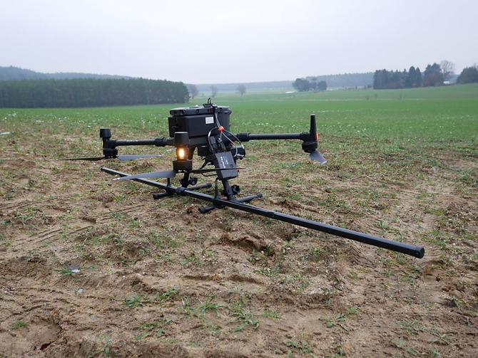
Drone-borne magnetometer system for high-resolution magnetic surveys over inaccessible, unsafe or large survey areas.
Overview
The UAV magnetometer is an uncrewed aerial system carrying a magnetometer payload on an underslung boom, acquiring continuous total magnetic intensity data over ground that is slow, unsafe or impractical to walk. Missions fly pre-programmed lines with RTK GNSS positioning and terrain-following altitude control, keeping sensor standoff constant so anomalies stay sharp. Datasets reveal geological structure, ferrous objects, buried utilities and mining voids, and are processed into anomaly maps and depth estimates. Payloads are offered as fluxgate or optically pumped sensors, matched to the survey objective together with airframe, power and processing workflow.
Available Options
Select an option and it will be included in your quote request.
Technical Specifications
- Payload
- Fluxgate or optically pumped magnetometer, underslung on rigid boom
- Sensor sensitivity
- 0.1 to 1 nT class, set by sensor selection
- Sampling
- Continuous acquisition, 10 to 100 Hz depending on sensor
- Positioning
- GNSS with RTK correction for survey-grade line and altitude accuracy
- Flight altitude
- Programmable terrain-following, typically 1 to 10 m above ground
- Endurance
- 20 to 45 minutes per sortie, airframe and payload dependent
- Airframe
- Industrial multi-rotor platform with folding arms and transport case
- Data output
- Total magnetic intensity, flight track, altitude and RTK position logs
- Deliverables
- Flight planning, acquisition, processing and anomaly mapping
Applications
- Mineral and ore body exploration
- Geological and structural mapping
- Groundwater and fracture zone investigation
- UXO and ferrous object detection
- Archaeological prospection
- Pipeline, cable and utility mapping
- Mining void and sinkhole screening
Frequently Asked Questions
Technical overview: specifying the UAV Magnetometer Survey System
The UAV Magnetometer Survey System is supplied by Gohar Global Cooperation to survey teams setting out structures, controlling earthworks and verifying as-built geometry across Pakistan. Selection starts with the accuracy your specification demands and the conditions your crews work in — dense urban sites, open corridors, or remote terrain with limited sky view.
Survey decisions are financial. An instrument that meets the accuracy clause but cannot export data into your office workflow costs more in rework than it saves at purchase, so we confirm software compatibility, export formats and field procedures before delivery.
Every supply includes operator training — setup, calibration checks, field routines and data handling — because productivity on site depends on the crew, not only on the instrument. Our engineers train both surveyors and assistants so a mixed-skill team produces consistent results.
Features and engineering highlights
A fleet that stays interchangeable
Prisms, poles, tribachs, batteries and data collectors are supplied consistently, so crews can share accessories and an instrument can be replaced without retraining the team.
Accuracy quoted honestly
Angle and distance accuracy, range and RTK performance are quoted for each model so comparisons between instruments are traceable. We do not present best-case laboratory figures as everyday site performance.
Data flow into your office workflow
Data collection software, export formats and compatibility with your design and reporting tools are confirmed before purchase, avoiding the integration surprises that slow survey teams down after delivery.
Built for Pakistani site conditions
Dust, heat, vibration in vehicle transport and daily tripod handling all shorten instrument life. Transport cases, sun protection and sensible calibration intervals are part of the specification rather than an optional extra.
Standards and compliance
UAV Magnetometer Survey System configurations are matched to the standard your project is judged against, including the methods commonly applied to survey equipment. Typical references include:
- ISO 17123 series — field procedures for testing surveying instruments
- Accuracy specifications quoted for angle and distance measurement
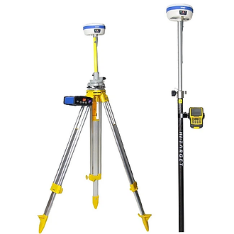
- GNSS RTK horizontal and vertical accuracy under stated conditions
- Manufacturer calibration and adjustment procedures
Applications of the UAV Magnetometer Survey System
The UAV Magnetometer Survey System is used where survey equipment decisions must be repeatable and defensible. In practice that means:
- Mineral and ore body exploration
- Geological and structural mapping
- Groundwater and fracture zone investigation
- UXO and ferrous object detection
- Archaeological prospection
- Pipeline, cable and utility mapping
- Mining void and sinkhole screening
Configuration and options
Each unit is quoted with a documented configuration so procurement can compare offers on equal scope; published specifications include payload, sensor sensitivity, sampling, positioning.
- Available options: Fluxgate magnetometer payload, Optically pumped caesium payload, RTK GNSS base and rover set, Terrain-following flight package, Processing and interpretation package
Industries that rely on the UAV Magnetometer Survey System
GGC supplies and supports this equipment for teams working across Pakistan's construction, testing and infrastructure sectors:
- Construction contractors and civil works
- Engineering consultants and designers
- Government departments and public works
- Infrastructure and corridor projects
- Mining, quarrying and earthworks
- Utilities and pipeline contractors
- Universities and survey training institutions
What procurement teams should confirm before ordering
A short checklist keeps the quotation honest and the commissioning predictable:
- Confirm the accuracy clause in your specification
- State site types: urban, corridor, remote or underground
- Check data export formats against office software
- Agree accessory set: prisms, poles, batteries, cases
- Plan calibration checks and adjustment intervals
- Confirm operator training and crew coverage
Buying UAV Magnetometer Survey System in Pakistan
Price comparisons between survey instruments only mean something at equal accuracy and equal accessory scope. Two total stations quoted at similar cost can differ by an order of accuracy class, and a GNSS rover's stated performance depends on the correction service and sky view available on your sites.
Think about the complete field kit before ordering: spare batteries, chargers for vehicle use, transport cases, prisms and poles. These are small line items that decide whether a crew completes a day's work or returns to the office early.
Support matters in a market where instruments are used hard. Confirm who performs adjustment checks, how long a repair takes, and whether accessories are held locally. GGC provides that route alongside delivery and training anywhere in Pakistan.
Why choose Gohar Global Cooperation for survey equipment
Gohar Global Cooperation equips survey departments across Pakistan with instruments, accessories and training from one supplier. Our engineers have supported contractors, consultants and government departments, so specifications reflect the way sites are actually run.
Delivery is coordinated nationwide, and training is included so crews operate confidently from the first day. When a fleet expands, accessories and instruments remain compatible and supported through the same channel.
Request a quotation for the UAV Magnetometer Survey System
Share your test methods, standards and quantities. Our engineers confirm the specification and respond with a quotation, delivery and installation timeline — usually within one business day.
Browse the full Survey Equipment range, or read about installation, calibration and training and the industries we serve.